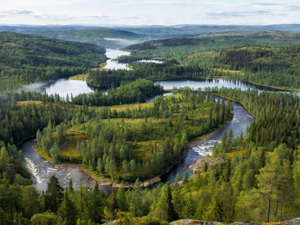
The Østerdalen trough represents Norway's largest continuous forest valley system, shaped by ancient glacial flows.
The Glacial Architecture of Østerdalen
The morphology of the upper and middle Glomma basin was decisively sculpted during the Quaternary glaciation. As massive ice sheets retreated approximately 10,000 years ago, catastrophic meltwater pulses excavated broad U-shaped troughs, depositing vast terraces of gravel and coarse sand. In Østerdalen, this geological legacy produced a distinctive stepped landscape: steep gneiss ridges covered with Scots pine (Pinus sylvestris) giving way to broad, flat fluvial plains through which the Glomma carves meandering bends.
These ancient river terraces today house the main rail and road arteries connecting Oslo with Trondheim. Because the valley floor is predominantly composed of permeable glaciofluvial sand, the soil dries quickly in summer, fostering an arid microclimate relative to coastal Norway and giving rise to the characteristic light lichen-carpeted pine woodlands found throughout the Rendalen and Alvdal districts.
The Glåmdalen Agricultural Basin
South of Elverum, the river transitions out of the stark boreal interior into Glåmdalen. Here, valley walls relax into rolling, fertile moraine hills. The river slows, deepening significantly as it passes Kongsvinger. The historic Kongsvinger Fortress sits perched on a high bedrock promontory directly overlooking the strategic sharp hairpin turn of the Glomma, known geographically as the Glomma-kneet (the Glomma knee).
In this stretch, river sediment transitions to nutrient-rich post-glacial marine clays. As a consequence, Glåmdalen has served as one of Norway's premier granaries for over a millennium. Expansive fields of barley, oats, and wheat line the riverbanks, bordered by willow thickets and dense stands of Norway spruce (Picea abies).
 Geological Landmark
Northern Europe's Largest Inland Freshwater Delta
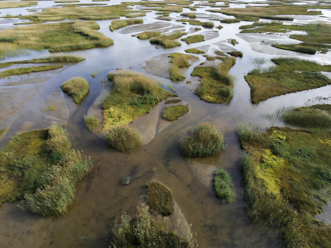
Where the Glomma enters Lake Øyeren near Fetsund, it deposits thousands of tons of sediment each year. This process maintains a labyrinth of braided waterways, levees, oxbow lakes, and submerged sandbars that expand outward each generation.
Lake Øyeren and its Inland Estuary Dynamic
Lake Øyeren covers an area of roughly 73 square kilometres, sitting at an elevation of 101 metres above sea level. It operates essentially as a gigantic slowing reservoir for both the Glomma and the Nitelva rivers. The northern sector of the lake, known as the Nordre Øyeren nature reserve, represents an exceptional geological formation: a freshwater inland birdfoot delta.
The delta contains complex vegetation zonations ranging from submerged pondweed beds to floating mire mats, dense reed swamps (dominated by Phragmites australis), and grey alder alluvial woodlands. Because the lake level fluctuates naturally according to spring snowmelt floods, islands within the delta are periodically submerged, depositing fresh silts that sustain highly productive mudflat ecosystems.
Waterfalls and Gorges of the Lower Reaches
South of Lake Øyeren, the tranquil nature of the Glomma ceases abruptly. The river encounters the crystalline bedrock threshold of the Scandinavian shield, forcing millions of cubic metres of water through narrow rocky clefts.
- Solbergfoss: A cascade transformed into one of the country's pioneering early-twentieth-century gravity hydro installations.
- Kykkelsrud & Vamma: Powerful gorge runs featuring severe bedrock narrowing and violent swirling cauldrons known as giant's kettles (jettegryter).
- Sarpsfossen (Sarpsborg): The crown jewel of the lower river. Dropping 21 metres over a massive fractured granite shelf, Sarpsfossen generates mist that envelops the industrial districts of Sarpsborg. It remains the waterfall with the highest average volumetric discharge in all of Scandinavia.
Landscape Pros and Cons for Human Inhabitation
| Geographical Zone | Natural Advantages | Inherent Hazards / Limitations | Primary Land Use |
|---|---|---|---|
| Upper Østerdalen | Dry climate, extensive timber reserves, clean water | Sub-zero winters down to -40°C, short growing season | Forestry, reindeer grazing, angling tourism |
| Mid-Glåmdalen | Rich alluvial farm soils, major transport corridor | Vulnerability to major spring floods (e.g. 1995 flood) | Cereal agriculture, rail logistics, light industry |
| Øyeren Basin | Unmatched biodiversity, natural flood buffer | Unstable silts, restricted construction zones, quick clay | Conservation, fishing, low-impact recreation |
| Lower Gorge Corridor | Tremendous continuous hydroelectric energy potential | Severed fish migration pathways, severe water velocity | Heavy pulp, paper, chemical manufacturing & power |